
Virtual Surveyor software directly integrates with Dropbox, OneDrive, and SharePoint. Once these cloud services are set up on your computer, they automatically appear as storage locations within the Virtual Surveyor apps—right alongside your local and network file drives. This means your cloud files are directly accessible in the Virtual Surveyor apps. The result is a seamless and cost-efficient workflow that lets you access your files from anywhere and collaborate effortlessly with your team.
Overview
- Streamlined Cloud Integration and Storage Locations
- Benefits of Working from Cloud Locations
- Related Video
- Tips and Tricks
Streamlined Cloud Integration and Storage Locations
Use the Cloud Storage Systems You Already Use
Streamlined Cloud Integration. Both the TerrainCreator and VirtualSurveyor apps use supported cloud storage systems.
Cloud storage is very simple to use. The cloud service(s) you are using on your computer is automatically available. Once you set up the supported cloud services on your computer, they appear as cloud locations in File Explorer, and in both the VirtualSurveyor and TerrainCreator apps. It really is that simple.
File Explorer | VirtualSurveyor/TerrainCreator App |
|---|---|
 |  |
Compatible Cloud Storage Locations. The following cloud service apps are currently supported and automatically available in Virtual Surveyor apps:
 | OneDrive |
 | SharePoint |
 | Dropbox |
Benefits of Working from Cloud Locations
Synchronize Your Files
The cloud service synchronization apps manage access to the files you need and moves projects that you don’t frequently use back to your cloud space to save memory on your local machine. They help streamline your file management process. The synchronization apps:
- Downloads what you need on command so you can work on files locally.
- Uploads any changes you make to files on your local machine.
- Frees up memory by moving unused files back to the cloud.
Data Follows You
OneDrive and personal Dropbox files and folders automatically appear in File Explorer once you have downloaded the sync app for each respective cloud service. You can then access all your VirtualSurveyor and TerrainCreator projects stored on the cloud service. Your Virtual Surveyor ID makes sure that our apps are aware of your Recent Files, regardless of the computer you work from.
- Access your projects on any computer you sign in to with your Virtual Surveyor ID.
- Recent projects are quickly accessible from any computer and can opened from any synced cloud location.
Desktop (in the office) | Laptop (on the go) |
|---|---|
 |  |
Collaborate in Teams
You can work as a team on a VirtualSurveyor project by using team folders, allowing all members to access and contribute to the same project seamlessly.
What is a team folder? A team folder is a shared workspace that is specifically designed for group collaboration. Unlike a regular personal folder that belongs to a single user, a Team Folder is set up and managed at the administrative organizational or team level.
- Learn about Team folders in Dropbox here.
- Learn how to add and remove people from Team Folders in Dropbox here.
How collaboration works. In a team folder, you'll need a person with admin rights that can manage access for team members on specific folders. If you save a project file to a cloud location that you have allowed others to use within a cloud service (Dropbox or OneDrive/SharePoint), a team member can access that VirtualSurveyor or TerrainCreator project file—along with any terrain files that go with it—on their own computer.
Where are my SharePoint folders? SharePoint folders do not automatically appear in File Explorer and thereby won't appear in the VirtualSurveyor or TerrainCreator apps. You need to sync them through the Teams app which will make the folders appear in File Explorer.

Open Virtual Surveyor projects simultaneously. Multiple users can open a project at the same time, but when a project is currently open by one user, any other user who opens the project on another computer has limited functionality through the View Only Mode. Any ability to edit the project is disabled (to avoid overwriting each other's work), but you can still navigate the Timeline and terrains, as well as use a few analysis tools.
Consolidate terrain files into a single folder. Use Copy Terrains to place all project terrains in the shared folder along with the project file. This ensures that everyone with access to the project folder can view the terrains used in the project file.
Share Externally
As an additional bonus of using Cloud Locations to store your project files, you can use your cloud service provider to share your VirtualSurveyor and TerrainCreator project files externally (with other Virtual Surveyor users outside of your company/organization). You can also share any exported .dxf, .csv, and other exported files from Virtual Surveyor software with others outside of your organization.
How to share externally. To share files externally, simply go to File Explorer and access a Cloud Location from there. Then use right-click to access the share menu and grant access to project folders to users outside your organization from there.
Share Externally with Dropbox | Share Externally with OneDrive |
|---|---|
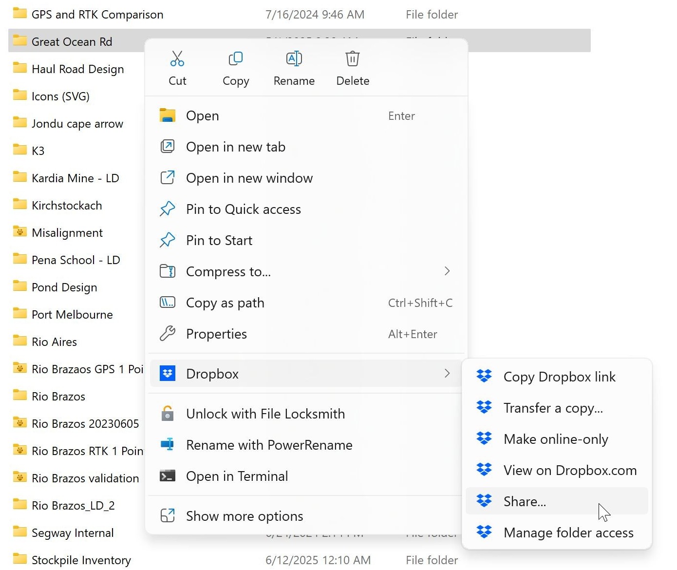 | 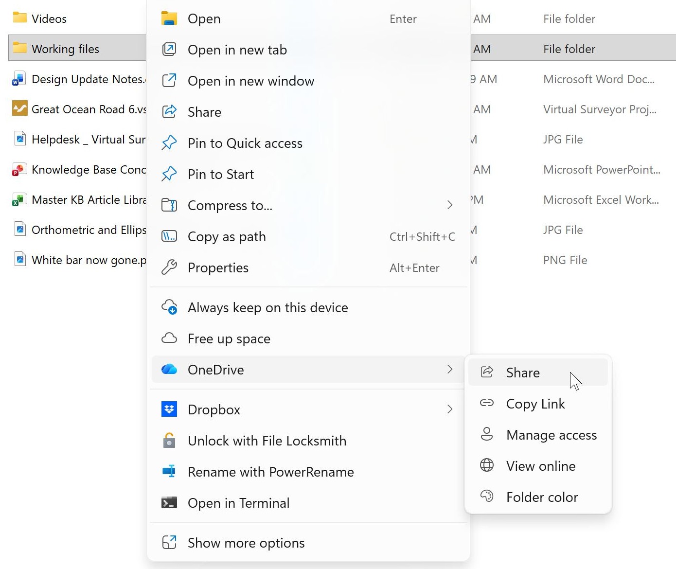 |
Related Video
Tips and Tricks
- Performance. When using these cloud services, a local copy of your terrain files is stored on your computer. This improves performance because all calculations—like stockpile volume, cut-and-fill—run directly on the computer without network latency—an advantage compared to fully cloud-based applications.
- Stability. Since terrain files are available locally, processing is not affected by slow or unstable network connections. This is especially important because VirtualSurveyor performs a large number of read operations.
- Favorite locations. You can use Favorite Locations to gain quick access to project folders on the cloud that you regularly work from.
- Auto backup and versioning. Let your cloud service handle historical versions and restore vital information in the project to avoid losing work.