
The Check Points tool allows you to verify the vertical accuracy of a drone dataset. You can compare the elevations of your Digital Surface Model (DSM) to independent points that are visible in the Viewport. Those points usually come from a Global Navigation Satellite System (GNSS) or total station survey.
The tool delivers vertical accuracy statistics and allows you to export an accuracy report.

The Check Points tool appears in the EXPORT tab and only works if an Elevation Terrain and some points are visible in the project.
Overview
How to Load Check Points
- Drag and drop the set of check points or click on choose files to load points.
- Go to the EXPORT tab.
- Click on the Check Points button.
- The check point statistics appear in a pop-up window.
| Check Points on the Elevation Terrain | Check Point Stats with an RMSE of 0.35 ft |
|---|---|
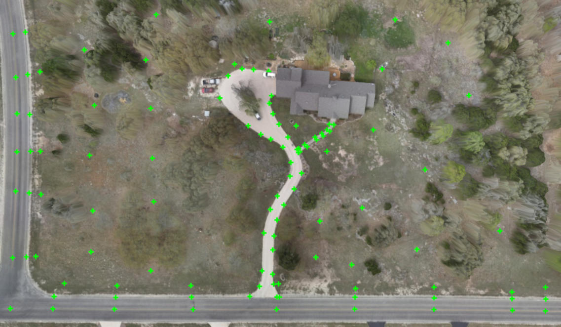 | 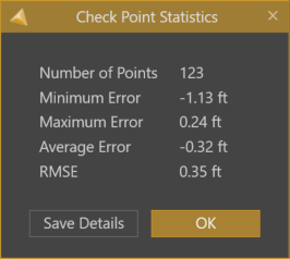 |
Hint! All the points that are visible in the Viewport are included in the accuracy check. Ensure that your ground check shots are the only active items before running the Check Points tool.
Export Accuracy Report
After using Check Points, you can save the results in a report.
- In the pop-up window, click on Save Details to generate an accuracy report.
- Specify a file name and a storage location.
- Click Save.
- A .txt file that contains the statistics and a .csv file, which contains the check point measurements, are created and is automatically opened.
Tips for Utilizing Check Points
- Based on the check point statistics, you can even enhance the vertical accuracy of your drone data.
- Use the average error to offset the elevation terrain.
- Make sure that check points and drone data are defined in the same coordinate and elevation systems.