
The contours surveyors most often need are the Surface Contours created by the survey that accurately reflect a modeled topographic surface, which can be exported. However, there are two kinds of contours available in the Virtual Surveyor app. The second type of contour is the view-only Contours Lens, which is used as a visual tool to help with analysis and reveal elevation changes at a glance.
We'll explain the power and versatility of generating Surface Contours in contrast to the benefits of using the Contours Lens. You can use both types of contours in Virtual Surveyor to make the most of your workflow and deliverables.
Overview
Surface Contours
Example of Contours generated from creating a lightweight topographic surface
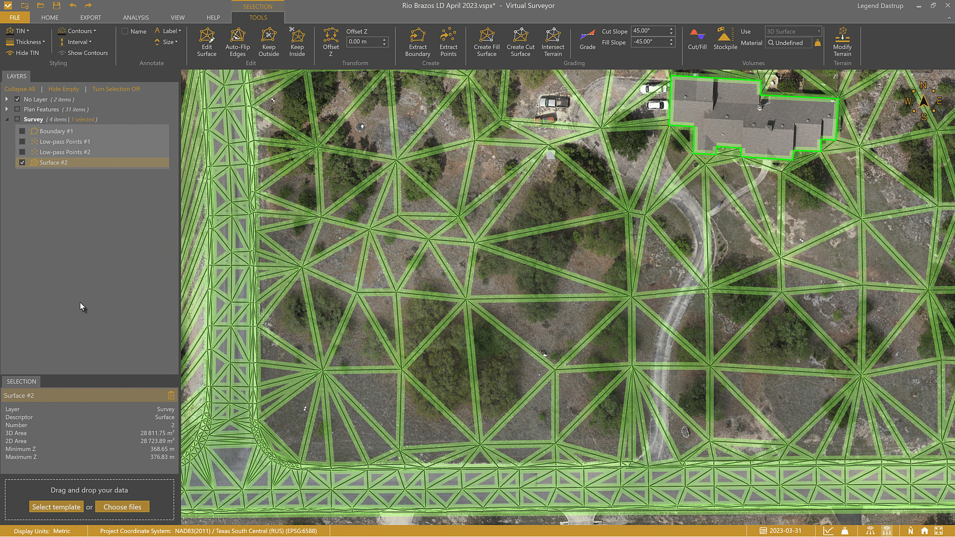
You create these contours from your survey points and breaklines. You can create a survey in many ways, from a simple point grid to an advanced topographic survey. The primary purpose of using contours comes from creating a lightweight model (survey) that can be used in CAD software.
Creating these contours requires some work, but they are a versatile option to save time and money for your projects.
The versatility and benefits of Surface Contours:
- Export to CAD. You can export the contours by themselves or as a TIN for further use in CAD software.
- Only include the necessary details. These contours offer a lot of detail while only using a small amount of data and display a clean look of the elevation changes for the modeled terrain.
- Accurate data. These contours are accurate because a surveyor specifically places the points intelligently. The surveyor places points to purposefully avoid or go under objects like buildings, trees, vehicles, etc.
- Update and change contour detail. At any point, even after generating the surface, you can do additional work to edit and refine the surface contours by adding breaklines, adding or removing survey shots, modifying the TIN, etc.
- Change how the Surface is displayed. Display the surface as contours, triangles (TIN), or both.
- Add details. You can add labels to these contours to showcase elevation, spacing, and other important details.
To use these contours, click Show Contours in the TOOLS tab when the surface is selected.
The Contours Lens
Example of the Contours Lens enabled. This powerful lens gives a great overview of the topography for analysis.
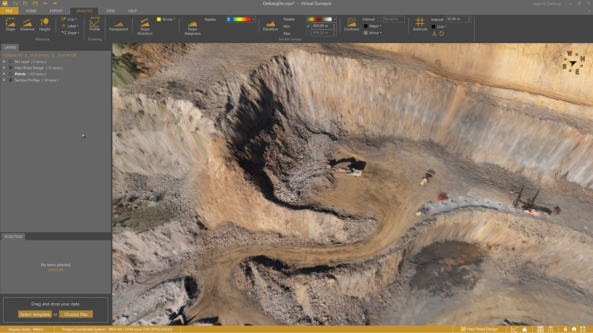
The Contours Lens is a view-only feature that is extremely useful for visual analysis and allows you to quickly observe and better understand the topography and its elevation changes at a glance. You can use them to help draw water flow lines or find the ridges and valleys for a solid concept of where to move dirt for a work site.
Advantages:
- These contours are created from screen pixels, which allows you to show or hide them quickly.
- They represent millions of points on the terrain that are great for presentation and viewing the general concept of the topography you are working on.
- These contours are dynamic by showing more detail when zoomed in and less detail when zoomed out as an overview of the terrain.
Disadvantages:
- You cannot export these contours because they only exist as pixels on your screen.
- When zoomed in closely, the contours use all the details from the elevation model and display as "jagged," "noisy," or "squiggly" lines that are too messy for design purposes.
- The contours are pixelated on machinery, trees, buildings, and anything else that is captured on the terrain, which is not an accurate representation of the terrain.
You can quickly enable this lens to reflect the elevation model (DSM, Elevation Terrain, or the DTM at ground level) and enable these contours in the Analysis tab within the Terrain Lenses section.
Direct Comparison of Contour Types
It can be tempting to try and export the contours that show from the Contours Lens, but this isn't possible because they are simply pixels displayed on your screen. The ability to create Surface Contours is the heart and soul behind Virtual Surveyor and embodies what a surveyor does in the field. Surveyors make the Surface Contours from a limited number of points and breaklines and, if captured properly, will include all the information from your topography to create an accurate and lightweight set of contours that can be used for design in CAD software.
We can directly compare the Surface Contours—made from the topography—and the Contours Lens.
Direct comparison between the Contours Lens (black lines) with line spacing at 3ft/1m apart, and survey generated Surface Contours at 10ft/3m (blue lines), 25ft/8m (yellow lines), 50ft/15m, and 100ft/30m.


As you can see, you can get just as much detail with Surface Contours as you can the Contours Lens, except the Surface Contours are far less 'noisy', and more importantly, are something an engineer or designer can actually work with.
Tips and Tricks
- You can export your contour lines as a .dxf, .xml., or .shp file for use in CAD or GIS software.
- You can use the Edit Surface tool to quickly add or remove details that will update your contours in real-time.